The inherent flexibility of layout of the 3D E-SCAN system allows instant adaptation to whatever is required to establish, shoot and remove survey instrumentation as part of a continuous sweep from background geology through the ore zone, and into background on the other side. Capturing a detailed geo-electric image of the entire orebody setting (including to great depth below) has been the key to many 3D E-SCAN surveys, especially where conventional surveys have had no success in "seeing" this example ore setting.
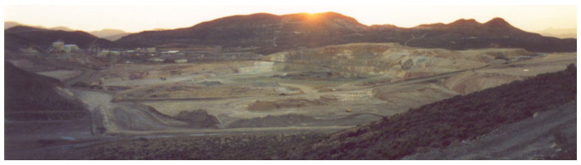
3D E-SCAN was operated through the operating Paradise Peak open pit mine, Nye County, Nevada, to complete an area-wide 3D mapping survey intended to display an exploration signature for the remaining orebody. Mine operations, including daily production blasting, were uninterrupted. 3D E-SCAN data were the usual optimum high density, multi-directional extra-deep 3D data that are normally collected in any survey. See detailed coverage of this case history elsewhere on this site.
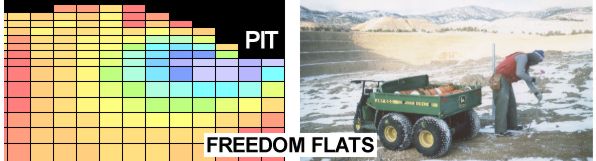
The smaller Freedom Flats pit in the Borealis trend of western Nevada (Walker Lane) was incorporated in the 3D E-SCAN survey that identified the previously-elusive geophysical signature of this deposit (and probably all of the Borealis Trend deposits). The section (from the true 3D earth model) highlights the mapped extension of silicified mineralization extending west under surface dumps, and accessible from the abandoned pit's floor. See detailed coverage of this case history elsewhere on this site.
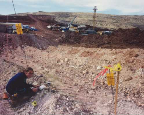
A crew member connects an E-SCAN switching box at a station in the middle of stripping for the mining of the USX orebody at the Hollister property, northern Carlin Trend, Nevada. Look for detailed coverage of this case history setting elsewhere on this site.